Counts & field observation
Our Telraam traffic counter
We use a small AI-powered sensor to count everyone using the street — on foot, by bike, and behind the wheel — and we publish the numbers for anyone to use.
What it is
A $360 sensor doing real work
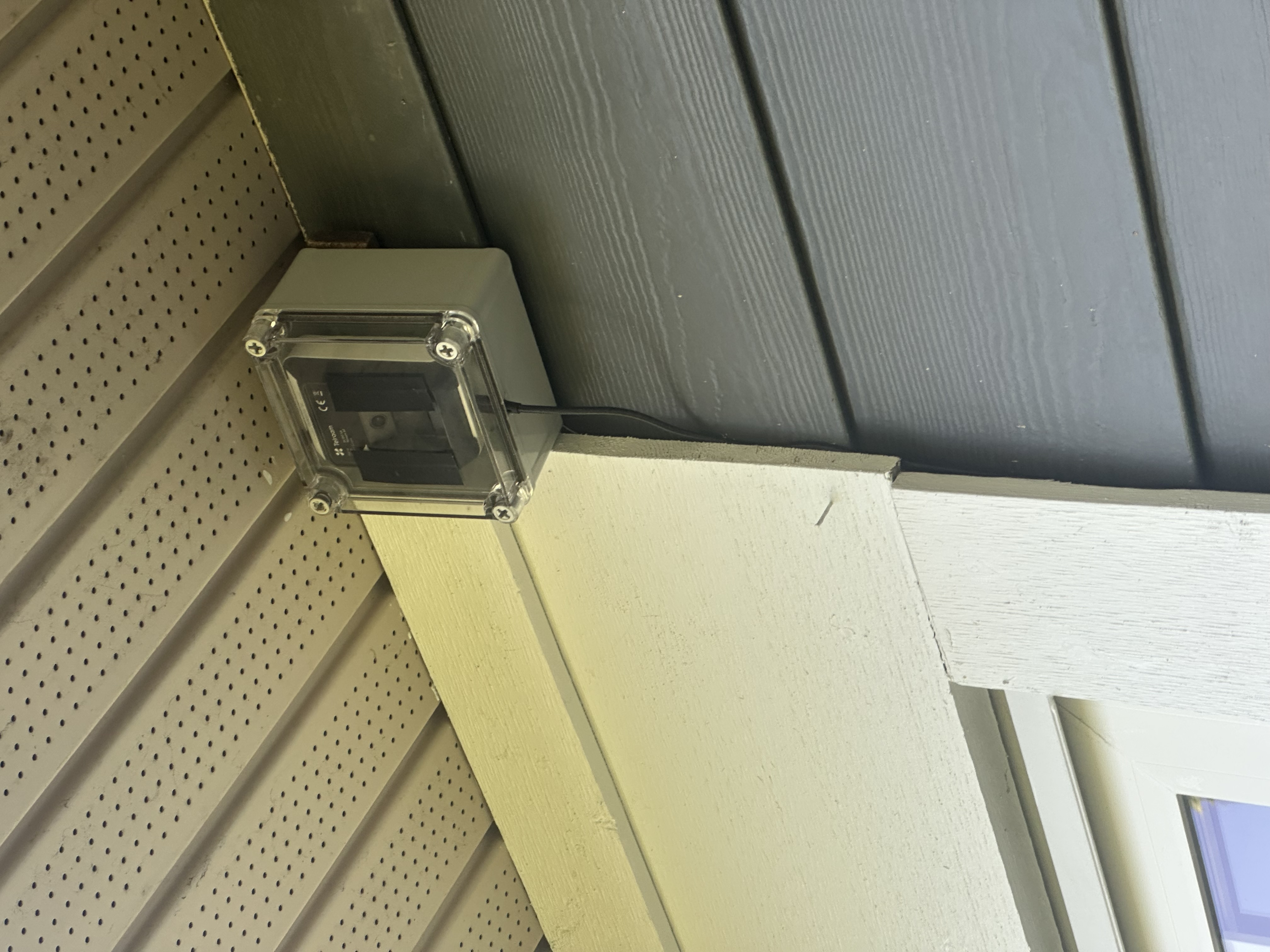
Our organization used donations to purchase a Telraam traffic counter for approximately $360 CAD (including taxes and shipping). It mounts in a window or on a pole and watches the street below.
Using AI, the Telraam automatically counts and classifies what passes by — day after day — without storing any identifying images.
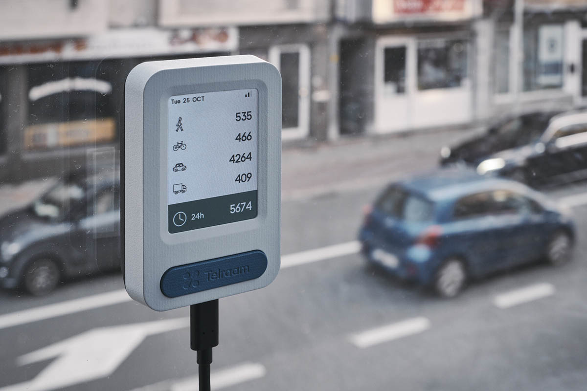
What the Telraam counts
One sensor, four categories of road user — counted continuously.
Bicycles
Cars
Heavy Goods Vehicles
Where it is
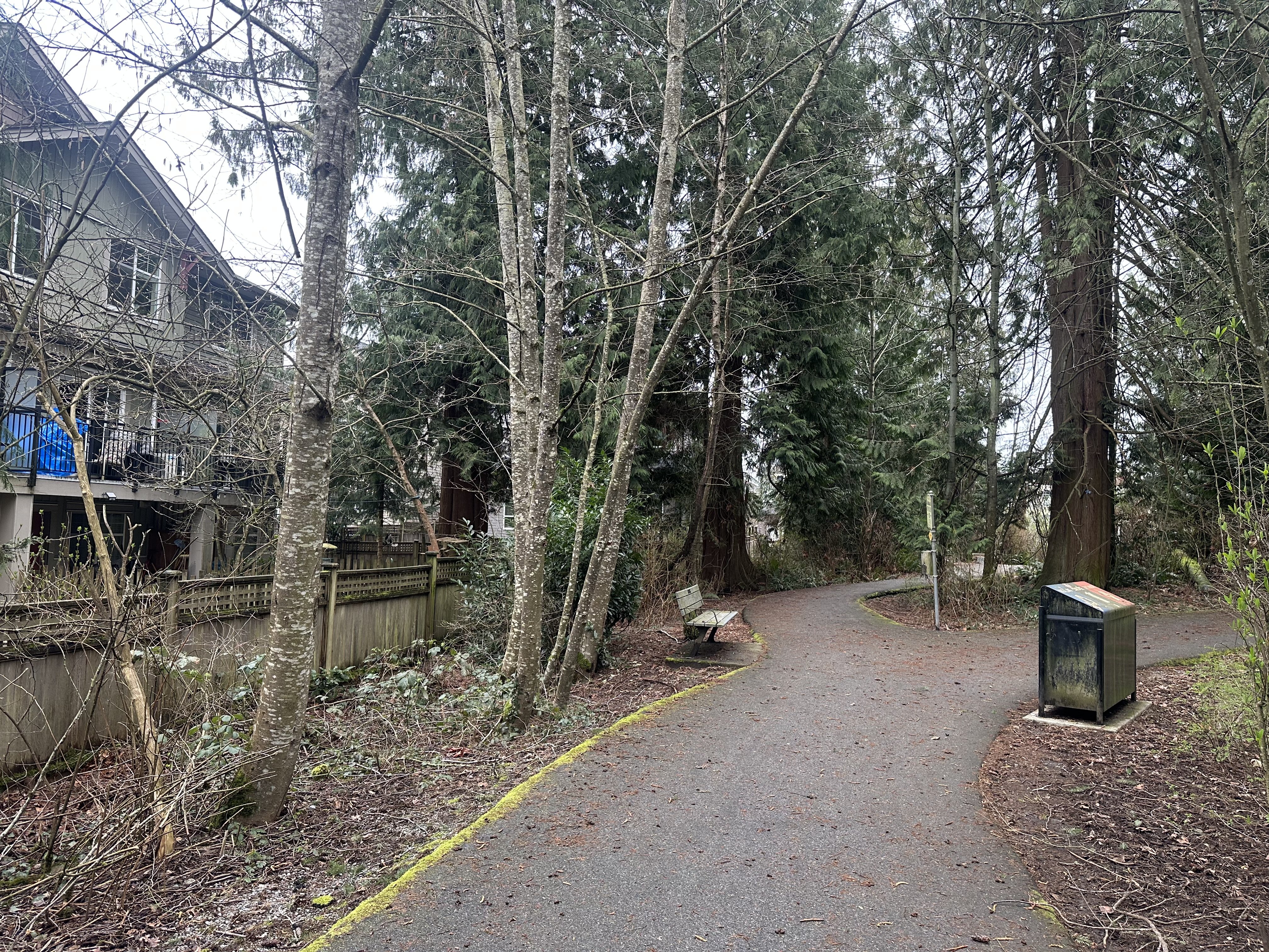
The Parry-Evans Trail, Willoughby
We installed our first Telraam - the first ever in British Columbia - along the Parry-Evans Trail in Willoughby. This lets us monitor changes in pedestrian and cycling counts before and after the baffle gates along the trail are changed as part of a Township of Langley pilot project.
Because the sensor runs continuously, it captures the day-to-day reality of how the trail is used — not just a one-off snapshot.
More Locations
Available to Anyone
We want to install more Telraams at various locations around Langley. If you are interested, consider donating or purchasing a Telraam for your home and letting us know!
Donate Purchase your own Telraam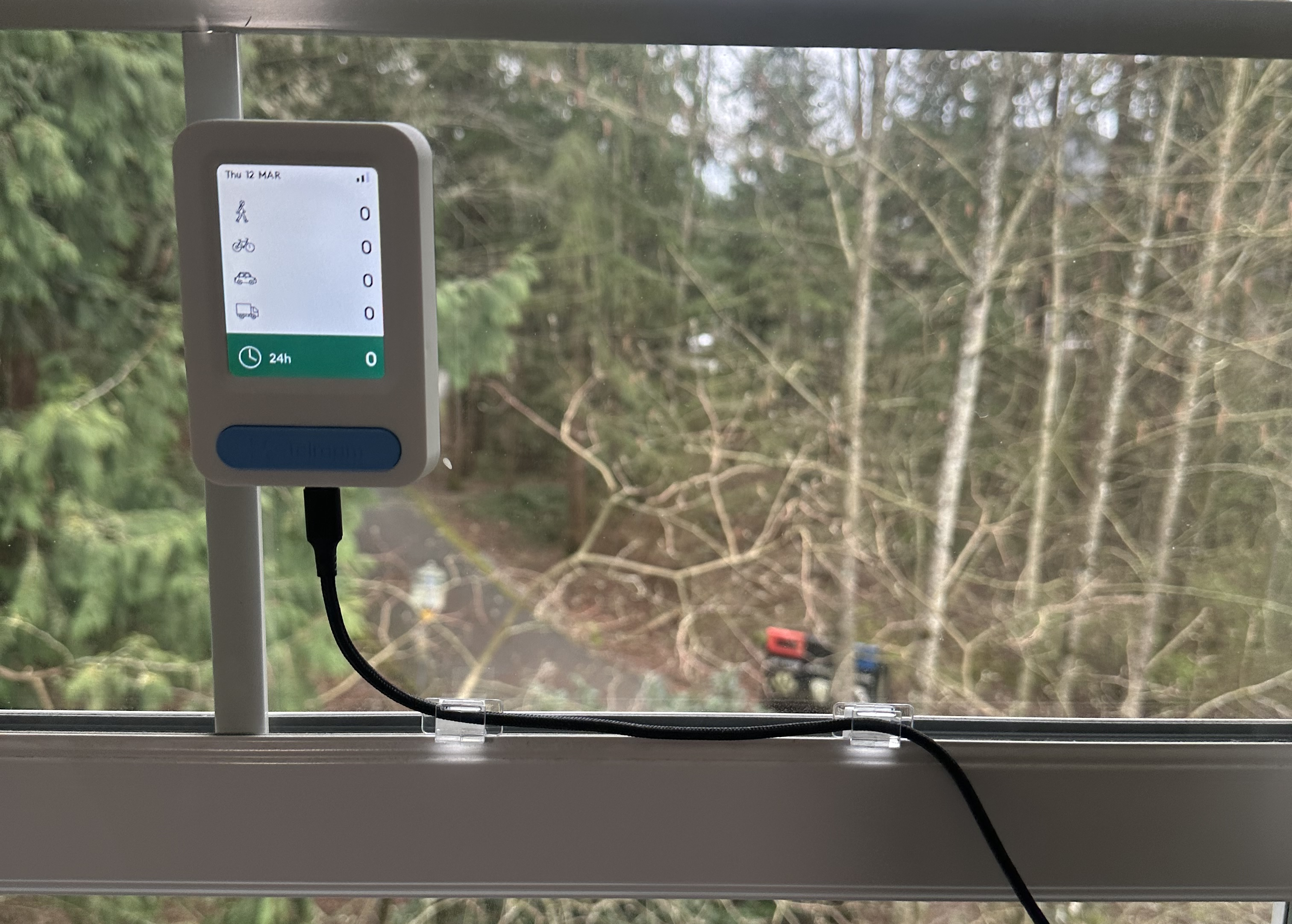
Open data
The numbers are public
Telraam data is openly available, and we publish our counts and methodology so residents, students, professionals, and local government can use them — for safety reviews, grant applications, or simply understanding how a street really works.
View our live Telraam data
In development
Telraam for Schools
We are developing a program to place Telraam counters near Langley schools, turning everyday traffic into a hands-on learning tool.
Real data, real streets
Students see how many people walk, roll, bike, and drive past their school each day — and how it changes with weather, seasons, and school events.
Learning with it
The counts support classroom work in math, geography, and science, and give students a concrete way to study active travel and road safety around their own school.
A record that lasts
Each participating school builds an ongoing dataset about its streets that the community can use for years to come.
Interested in hosting a Telraam at your school? Email contact@langleyurbanistsociety.ca.